My previous blog turn out to be very popular but unfortunately it is still not good enough, the Visual Interaction was just a hack by combining two Maps together with a big compromise the Zoom does not work and that’s very annoying ( Icon map is amazing, but still has to operate inside PowerBI framework)
The Second issue PowerBI is very chatty and insteading of sending 1 SQL Query by selection, it sends two SQL Queries, so selecting two points start and finish will generate 4 SQL Queries, usually I don’t care much, but in this case, it is relatively heavy calculation, and 1 extra Query can change the experience from this is a nice demo to I can do that at Work.
This behavior is hard to fix because it is basically how PowerBI was designed in the first place, the assumption was; you create a visual and the values change based on external filter selection or cross filtering from other visual, but there are a class of User interaction where the visual itself is the filter , a typical scenario is updating a visual title based on rows selected.
Instead of theoretical talks let’s rebuild the same visual in Tableau using parameter actions
Define a Parameter

Define SQL Query
WITH
      initial_parameter AS (
      SELECT
        *
      FROM
        UNNEST(split(<Parameters.TagsList> , ', ')) AS element ),
      mynetwork AS (
      SELECT
        ARRAY_AGG(geometry) roads   FROM   `test-187010.gis_free.brisbane_Road_Network_cluster` ),
      calculation AS(
      SELECT
        `libjs4us.routing.geojson_path_finder`(roads, st_geogfromtext(a.element), st_geogfromtext(b.element)) AS tt
      FROM
        mynetwork,    initial_parameter a,    initial_parameter b
      WHERE
        a.element>b.element
      LIMIT
        100),
        result as (
    SELECT
       1 as dummy,tt.weight    AS len,tt.path AS GEO
    FROM  calculation),
    points_extract as (
    SELECT ST_PointN(geo, idx) mypoint,len, dummy,idx
  FROM result,
  unnest(GENERATE_ARRAY(1,ST_NUMPOINTS(geo))) idx  )
  select len,  st_y(mypoint) as lat, st_x(mypoint) as lng, cast (idx as string) idx ,1 as type from points_extract
  union all
  select null as len,st_y(center_location) as lat, st_x(center_location) as lng, st_astext(center_location) as idx, 2 as type  from test-187010.gis_free.Brisbane_Bus_Stop
Define Parameter Action
in Tableau you can define exactly what happen when you select point either it will filter or update a parameter in this case we want Tableau to add the value selected to the previous selection , as for calculating distance you need Start and finish point, PowerBI by default will do that using icon map, so far so good both Product have the same behavior
Auto Update Behavior

Unlike PowerBI, Tableau auto update the Map if the data change, and because I am using only 1 visual, the zoom works and the experience is more pleasant, Tableau send only 1 SQL Query by selection.
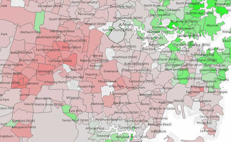
See here another example, when you click on a suburb, the Map Auto update and change colors relative to the suburb selected, very simple yet very powerful
And please I have zero interest in this useless debate who is a better BI tool, I just want PowerBI to implement a similar behavior or giving us an alternative, Maybe make a Visual accept multiple datasets.
As a user all I can do is to show my displeasure in public and hope other users will vote

One thought on “Calculate route distance, Tableau vs PowerBI”